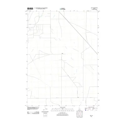
2010 Map of Naf
USGS Topo · Published 2010About this map
Naf and Kelso anchor this rural corridor in Cassia County, Idaho, where the landscape is defined by the drainage networks of the Raft River and Clear Creek. The map documents a sparse agricultural and ranching district near the state line, characterized by a functional grid of country routes such as E Strevell Rd and Bridge-Naf Rd. A significant historical remnant is found in the northeast, where Old Railroad Grade Rd traces a linear path through the valley, marking the legacy of former transportation infrastructure that once connected these remote settlements. Numerous smaller seasonal waterways, including Round Mountain Creek, Holt Creek, and Barnes Creek, descend from the surrounding high ground to feed the central valley floor, illustrating the vital role of water management in this arid high-desert environment.
Find a feature on this map
15 named features on this map. Tap any name to fly to it.
Don’t see what you’re looking for? This feature index may not catch every label — zoom into the map to look around manually.
Map Details
Editions of this 2010 Naf Map
This is the sole edition of this map. No revisions or reprints were ever made.
Other maps of this area

1954 · Pocatello
USGS Topo · 1:250,000

1954 · Brigham City
USGS Topo · 1:250,000

1958 · Pocatello
USGS Topo · 1:250,000

1958 · Brigham City
USGS Topo · 1:250,000

1959 · Strevell
USGS Topo · 1:62,500

1959 · Kelton Pass
USGS Topo · 1:62,500

1959 · Park Valley
USGS Topo · 1:62,500

1962 · Brigham City
USGS Topo · 1:250,000

1968 · Kane Canyon
USGS Topo · 1:24,000

1968 · Naf
USGS Topo · 1:24,000