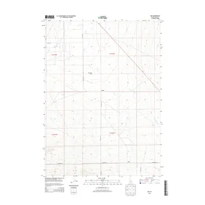
2013 Map of Naf
USGS Topo · Published 2013About this map
Naf and Kelso anchor this rural landscape in the high desert of Cassia County, where the Raft River Valley opens between rising slopes. The hydrology of the region is defined by the Raft River and its seasonal tributaries, including Clear Cr and Round Mountain Cr, which carve paths through the alluvial terrain. This 2013 survey illustrates the sparse but critical road network necessary for ranching and transit in southern Idaho, notably Id-81 cutting across the northern sections and the intersection of Bridge Naf Rd and E Strevell Rd near the Utah border. The map provides a clear record of land division and water rights, tracing Holt Cr and Barnes Cr as they feed into the valley floor, supporting a way of life deeply tied to the basin's geography.
Find a feature on this map
18 named features on this map. Tap any name to fly to it.
Don’t see what you’re looking for? This feature index may not catch every label — zoom into the map to look around manually.
Map Details
Editions of this 2013 Naf Map
This is the sole edition of this map. No revisions or reprints were ever made.
Other maps of this area

1954 · Pocatello
USGS Topo · 1:250,000

1954 · Brigham City
USGS Topo · 1:250,000

1958 · Pocatello
USGS Topo · 1:250,000

1958 · Brigham City
USGS Topo · 1:250,000

1959 · Strevell
USGS Topo · 1:62,500

1959 · Kelton Pass
USGS Topo · 1:62,500

1959 · Park Valley
USGS Topo · 1:62,500

1962 · Brigham City
USGS Topo · 1:250,000

1968 · Kane Canyon
USGS Topo · 1:24,000

1968 · Naf
USGS Topo · 1:24,000