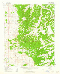
1959 Map of Nageezi
USGS Topo · Published 1962About this map
Nageezi and the surrounding high desert terrain in San Juan County were defined by the burgeoning energy industry of the late 1950s. This survey, based on 1955 aerial photography, reveals the extensive infrastructure of the San Juan Basin Gas Field and Blanco Gas Field. Numerous oil wells and gas wells dot the mesa tops and canyon floors, connected by the Largo Compressor Station and its associated pipelines.
Find a feature on this map
30 named features on this map. Tap any name to fly to it.
Don’t see what you’re looking for? This feature index may not catch every label — zoom into the map to look around manually.
Map Details
Editions of this 1959 Nageezi Map
2 editions found
Other maps of this area

1889 · Largo
USGS Topo · 1:250,000

1895 · Largo
USGS Topo · 1:250,000

1954 · Aztec
USGS Topo · 1:250,000

1958 · Aztec
USGS Topo · 1:250,000

1959 · Gould Pass
USGS Topo · 1:62,500

1959 · Nageezi
USGS Topo · 1:62,500

1960 · Bloomfield
USGS Topo · 1:62,500

1962 · Aztec
USGS Topo · 1:250,000

1963 · Tayfoya Canyon
USGS Topo · 1:24,000

1963 · Gonzales Mesa
USGS Topo · 1:24,000