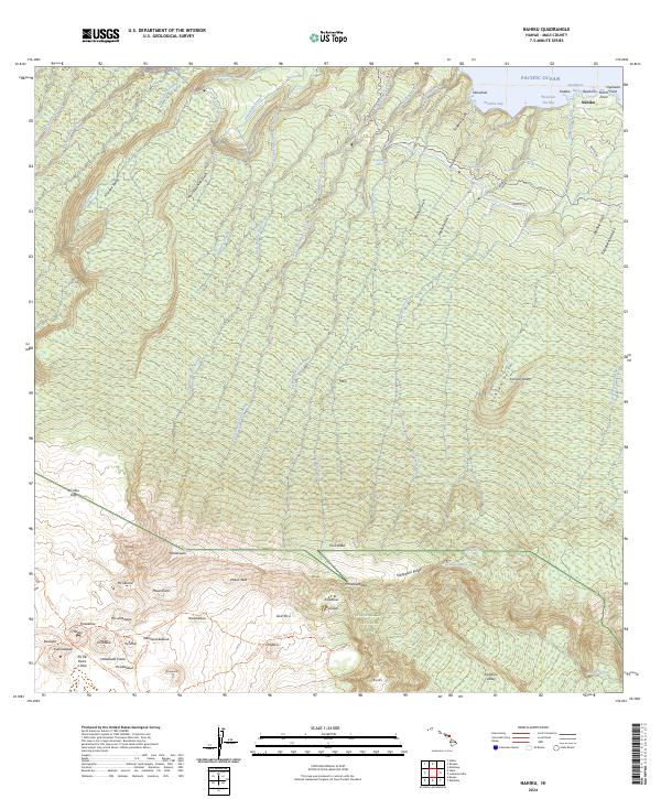
2024 Map of Nahiku
USGS Topo · Published 2024About this map
Haleakalā National Park and the adjacent Haleakalā Wilderness dominate the southern portion of this landscape, where the dramatic volcanic terrain of the Koʻolau Gap descends toward the northern coast of Maui. The map illustrates a dense network of perennial streams and gulches, such as East Wailua Nui Stream and Kopiliula Gulch, that have carved deep valleys into the island's windward slopes. This drainage pattern culminates in coastal features like Waiohue Bay and the settlement at Nāhiku.
Find a feature on this map
84 named features on this map. Tap any name to fly to it.
Don’t see what you’re looking for? This feature index may not catch every label — zoom into the map to look around manually.
Map Details
Editions of this 2024 Nahiku Map
This is the sole edition of this map. No revisions or reprints were ever made.
Other maps of this area

1954 · Maui
USGS Topo · 1:250,000

1957 · Kilohana
USGS Topo · 1:24,000

1957 · Kipahulu
USGS Topo · 1:24,000

1957 · Hana
USGS Topo · 1:24,000

1957 · Haiku
USGS Topo · 1:24,000

1957 · Lualailua Hills
USGS Topo · 1:24,000

1957 · Nahiku
USGS Topo · 1:24,000

1957 · Kaupo
USGS Topo · 1:24,000

1957 · Keanae
USGS Topo · 1:24,000

1966 · Maui
USGS Topo · 1:250,000