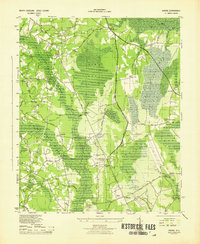
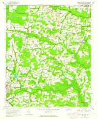
1943 Map of Nakina
USGS Topo · Published 1943About this map
Nakina and the surrounding coastal plain of Columbus County are defined by a network of drainage features and small crossroads communities during the early 1940s. The landscape is dominated by the broad expanse of Big Bay and numerous wetlands like Simmons Bay and Boggy Bay. Settlement patterns follow established routes such as Nakina Road and Lebanon Rd, where small hubs like Antioch, Needmore, and Mollie provide focal points for local life.
Find a feature on this map
54 named features on this map. Tap any name to fly to it.
Don’t see what you’re looking for? This feature index may not catch every label — zoom into the map to look around manually.
Map Details
Editions of this 1943 Nakina Map
3 editions found
Other maps of this area

1943 · Pireway
USGS Topo · 1:31,680

1943 · Nakina
USGS Topo · 1:24,000

1943 · Freeland
USGS Topo · 1:24,000
1953 · Pireway
USGS Topo · 1:24,000

1953 · Chadbourn
USGS Topo · 1:62,500

1953 · Florence
USGS Topo · 1:250,000

1954 · Florence
USGS Topo · 1:250,000

1955 · Whiteville
USGS Topo · 1:62,500
1962 · Goretown
USGS Topo · 1:24,000
1962 · Tabor City East
USGS Topo · 1:24,000