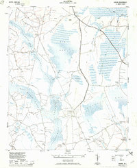
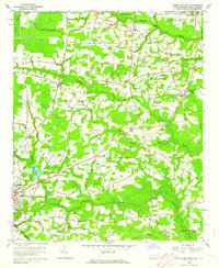
1943 Map of Nakina
USGS Topo · Published 1950About this map
Beaverdam Swamp and the expansive Big Bay dominate this low-lying landscape in Columbus County, where a network of fords and bridges once connected dispersed communities. In the early 1940s, the rural economy of this region relied on winding dirt roads and old timbering paths like the Old Tram Road. Small settlements and local landmarks often centered around water crossings, such as Pole Bridge Crossing and the nearby Pole Bridge Church.
Find a feature on this map
46 named features on this map. Tap any name to fly to it.
Don’t see what you’re looking for? This feature index may not catch every label — zoom into the map to look around manually.
Map Details
Editions of this 1943 Nakina Map
3 editions found
Other maps of this area

1943 · Pireway
USGS Topo · 1:31,680

1943 · Nakina
USGS Topo · 1:24,000

1943 · Freeland
USGS Topo · 1:24,000
1953 · Pireway
USGS Topo · 1:24,000

1953 · Chadbourn
USGS Topo · 1:62,500

1953 · Florence
USGS Topo · 1:250,000

1954 · Florence
USGS Topo · 1:250,000

1955 · Whiteville
USGS Topo · 1:62,500
1962 · Goretown
USGS Topo · 1:24,000
1962 · Tabor City East
USGS Topo · 1:24,000