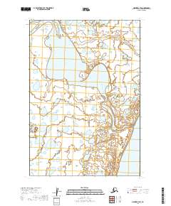
2019 Map of Naknek A-3 SW
USGS Topo · Published 2019About this map
Egegik River winds through this low-lying Alaskan landscape in the Lake and Peninsula region, serving as a vital hydrologic link in the Bristol Bay watershed. The river's broad, braided course dominates the central portion of the sheet, surrounded by a complex network of smaller ponds and wetlands typical of the coastal tundra. In the southeastern corner, the map reveals the northern edge of Becharof Lake, one of the largest bodies of freshwater in the state. This 2019 survey documents the intricate water patterns and township boundaries of t24s r47w and t25s r46w, illustrating a remote wilderness where the landscape is defined almost entirely by its water systems and lack of permanent road infrastructure.
Find a feature on this map
6 named features on this map. Tap any name to fly to it.
Don’t see what you’re looking for? This feature index may not catch every label — zoom into the map to look around manually.
Map Details
Editions of this 2019 Naknek A-3 SW Map
This is the sole edition of this map. No revisions or reprints were ever made.
Other maps of this area

1943 · Ugashik
USGS Topo · 1:250,000

1948 · Ugashik
USGS Topo · 1:250,000

1949 · Ugashik
USGS Topo · 1:250,000

1951 · Ugashik D-3
USGS Topo · 1:63,360

1951 · Ugashik D-4
USGS Topo · 1:63,360

1951 · Naknek A-4
USGS Topo · 1:63,360

1951 · Naknek A-3
USGS Topo · 1:63,360

1952 · Naknek
USGS Topo · 1:250,000

1963 · Ugashik
USGS Topo · 1:250,000

1964 · Naknek
USGS Topo · 1:250,000