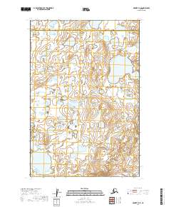
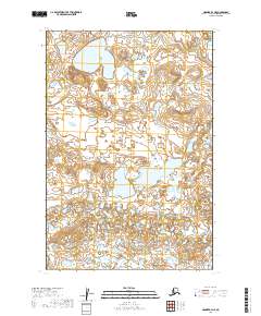
2019 Map of Naknek C-4 SE
USGS Topo · Published 2019About this map
The complex hydrology of the Alaska Peninsula is evident in this landscape, where the administrative boundary between Bristol Bay Borough and Lake and Peninsula Borough cuts across a vast network of unnamed ponds and wetlands. Two primary drainages, Big Cr and Johnson Hill Cr, meander through the low-lying terrain, illustrating the intricate water systems that characterize this region. This survey, compiled from data spanning more than a century, reflects the continuity of these remote waterways. The map is primarily structured by the Public Land Survey System, including t18s r48w and t18s r47w, which provide a formal grid over a wilderness largely devoid of human infrastructure or roads.
Find a feature on this map
7 named features on this map. Tap any name to fly to it.
Don’t see what you’re looking for? This feature index may not catch every label — zoom into the map to look around manually.
Map Details
Editions of this 2019 Naknek C-4 SE Map
This is the sole edition of this map. No revisions or reprints were ever made.
Other maps of this area

1952 · Naknek
USGS Topo · 1:250,000

1952 · Naknek B-3
USGS Topo · 1:63,360

1952 · Naknek B-4
USGS Topo · 1:63,360

1952 · Naknek C-3
USGS Topo · 1:63,360

1952 · Naknek C-4
USGS Topo · 1:63,360

1964 · Naknek
USGS Topo · 1:250,000
2019 · Naknek B-4 NW
USGS Topo · 1:25,000
2019 · Naknek C-3 NW
USGS Topo · 1:25,000
2019 · Naknek B-3 NW
USGS Topo · 1:25,000
2019 · Naknek B-4 NE
USGS Topo · 1:25,000