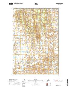
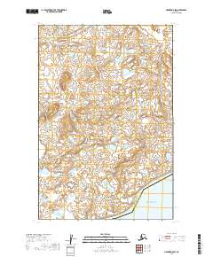
2019 Map of Naknek D-6 SE
USGS Topo · Published 2019About this map
Portage Cr flows through the northeast corner of this remote Alaskan landscape, located within the Dillingham Census Area. The terrain is characterized by a dense network of wetlands and small ponds, illustrating the complex hydrography of the Bristol Bay region. Surveyed by the U.S. Geological Survey, the map delineates various townships and ranges including t15s r51w and t16s r50w, reflecting the systematic grid of the Bureau of Land Management. This 2019 survey provides a precise record of the topographic contours and water bodies in a largely roadless area of the state.
Find a feature on this map
5 named features on this map. Tap any name to fly to it.
Don’t see what you’re looking for? This feature index may not catch every label — zoom into the map to look around manually.
Map Details
Editions of this 2019 Naknek D-6 SE Map
This is the sole edition of this map. No revisions or reprints were ever made.
Other maps of this area

1952 · Naknek
USGS Topo · 1:250,000

1952 · Naknek C-5
USGS Topo · 1:63,360

1952 · Naknek C-6
USGS Topo · 1:63,360

1952 · Naknek D-5
USGS Topo · 1:63,360

1952 · Naknek D-6
USGS Topo · 1:63,360

1964 · Naknek
USGS Topo · 1:250,000
2019 · Naknek C-6 NW
USGS Topo · 1:25,000
2019 · Naknek D-6 NE
USGS Topo · 1:25,000
2019 · Naknek D-5 NW
USGS Topo · 1:25,000
2019 · Naknek D-5 SW
USGS Topo · 1:25,000