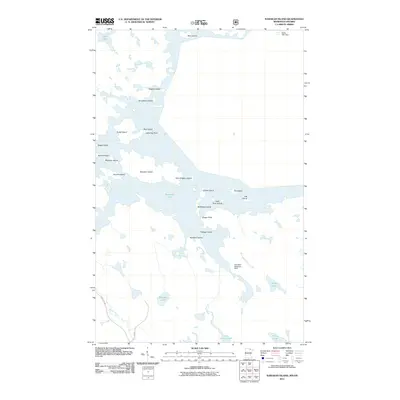
2011 Map of Namakan Island
USGS Topo · Published 2011About this map
Namakan Lake dominates this borderland landscape, where a dense archipelago of islands defines the water-and-wilderness geography of the Rainy River District. The map highlights the engineered and logistical points of this remote region, specifically the Kettle Falls Dam at Kettle Falls and the Namakan Seaplane Base, which serve as vital infrastructure in an area where transport relies heavily on water and air.
Find a feature on this map
33 named features on this map. Tap any name to fly to it.
Don’t see what you’re looking for? This feature index may not catch every label — zoom into the map to look around manually.
Map Details
Editions of this 2011 Namakan Island Map
This is the sole edition of this map. No revisions or reprints were ever made.
Other maps of this area

1954 · International Falls
USGS Topo · 1:250,000

1957 · International Falls
USGS Topo · 1:250,000

1958 · International Falls
USGS Topo · 1:250,000

1967 · Namakan Island
USGS Topo · 1:24,000

1967 · Marion Lake
USGS Topo · 1:24,000

1967 · Hale Bay
USGS Topo · 1:24,000

1967 · Kempton Bay
USGS Topo · 1:24,000
1967 · Kettle Falls
USGS Topo · 1:24,000

1967 · Johnson Lake
USGS Topo · 1:24,000

1968 · Ash River SE
USGS Topo · 1:24,000