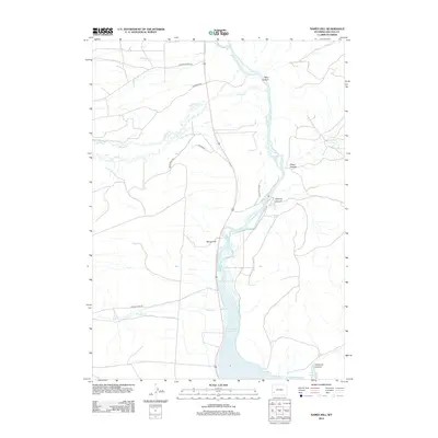
2012 Map of Names Hill
USGS Topo · Published 2012About this map
Names Hill rises above the western bank of the Green River, serving as a silent witness to the migration paths that crossed this Wyoming corridor. This landscape is defined by the intersection of water and historical transit, where the Sublette Cutoff and Bondurant Rd navigate the rugged breaks between the river valley and the Foothills. The southern portion of the sheet is dominated by the northern reaches of the Fontenelle Reservoir, which submerged portions of the river valley that were once part of the early ranching and overland trail network.
Find a feature on this map
16 named features on this map. Tap any name to fly to it.
Don’t see what you’re looking for? This feature index may not catch every label — zoom into the map to look around manually.
Map Details
Editions of this 2012 Names Hill Map
This is the sole edition of this map. No revisions or reprints were ever made.
Other maps of this area

1945 · Fort Hill
USGS Topo · 1:62,500

1947 · Fort Hill
USGS Topo · 1:62,500

1955 · Preston
USGS Topo · 1:250,000

1958 · Preston
USGS Topo · 1:250,000

1962 · Preston
USGS Topo · 1:250,000

1968 · Anderson Canyon
USGS Topo · 1:24,000

1968 · Fontenelle Reservoir SE
USGS Topo · 1:24,000

1968 · Names Hill
USGS Topo · 1:24,000

1968 · Fontenelle Reservoir SW
USGS Topo · 1:24,000

1969 · La Barge
USGS Topo · 1:24,000