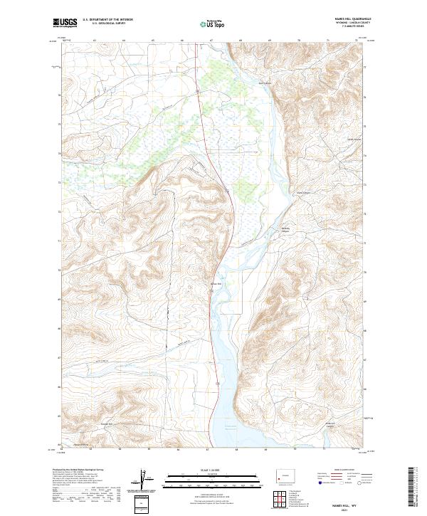
2021 Map of Names Hill
USGS Topo · Published 2021About this map
The Green River flows through this Wyoming landscape, carving a wide valley bounded by high terrain and dramatic breaks. Names Hill stands as a prominent landmark on the west bank, overlooking a sophisticated network of irrigation systems including the Hyrum Smith Ditch, Delaney Ditch, and Sublet Ditch. These waterways reflect the agricultural engineering required to manage this arid terrain, feeding off the river and its tributaries like La Barge Cr.
Find a feature on this map
27 named features on this map. Tap any name to fly to it.
Don’t see what you’re looking for? This feature index may not catch every label — zoom into the map to look around manually.
Map Details
Editions of this 2021 Names Hill Map
This is the sole edition of this map. No revisions or reprints were ever made.
Other maps of this area

1945 · Fort Hill
USGS Topo · 1:62,500

1947 · Fort Hill
USGS Topo · 1:62,500

1955 · Preston
USGS Topo · 1:250,000

1958 · Preston
USGS Topo · 1:250,000

1962 · Preston
USGS Topo · 1:250,000

1968 · Anderson Canyon
USGS Topo · 1:24,000

1968 · Fontenelle Reservoir SE
USGS Topo · 1:24,000

1968 · Names Hill
USGS Topo · 1:24,000

1968 · Fontenelle Reservoir SW
USGS Topo · 1:24,000

1969 · La Barge
USGS Topo · 1:24,000