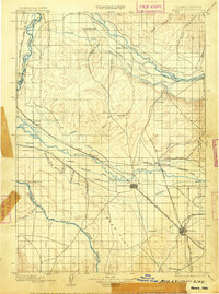
1898 Map of Nampa
USGS Topo · Published 1905About this map
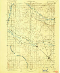
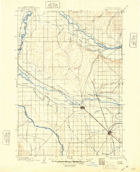
Nampa and Caldwell emerge as regional hubs in this late nineteenth-century survey, which details the extensive transformation of the high desert through irrigation. The landscape is defined by an intricate network of water management, including the Phyllis Canal, Ridenbaugh Canal, and the Keller Ditch, all essential for supporting agriculture in the Payette Valley and beyond. The Oregon Short Line serves as the primary transportation artery, connecting established settlements like Emmett and Parma to broader markets. Beyond the burgeoning towns, the map identifies localized landmarks and rural outposts such as Falks Store, Lemp, and Leonard. The topography reveals the complex drainage systems of Graveyard Gulch and Langley Gulch leading toward the Snake River, illustrating the rugged environment that early settlers and engineers sought to tame during Idaho's early statehood.
Find a feature on this map
56 named features on this map. Tap any name to fly to it.
Don’t see what you’re looking for? This feature index may not catch every label — zoom into the map to look around manually.
Map Details
Editions of this 1898 Nampa Map
4 editions found
Other maps of this area

1892 · Boise
USGS Topo · 1:125,000

1892 · Bisuka
USGS Topo · 1:125,000

1892 · Silver City
USGS Topo · 1:125,000

1894 · Bisuka
USGS Topo · 1:125,000

1894 · Silver City
USGS Topo · 1:125,000

1894 · Squaw Creek
USGS Topo · 1:125,000

1897 · Boise
USGS Topo · 1:125,000

1897 · Weiser
USGS Topo · 1:125,000

1898 · Nampa
USGS Topo · 1:125,000

1898 · Silver City
USGS Topo · 1:125,000