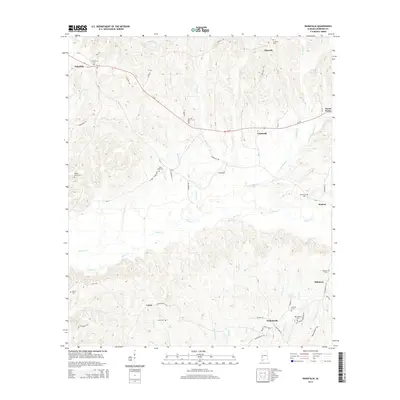
2014 Map of Nanafalia
USGS Topo · Published 2014About this map
Nanafalia and Nicholsville anchor this 2014 geographic study of Marengo County, Alabama, where a network of small settlements is connected by the winding route of Al-10. The landscape is defined by its numerous watercourses, including Sweetwater Cr, Horse Cr, and Nichols Cr, which carve through the region's terrain. For genealogists and local historians, the sheet is particularly dense with community landmarks, featuring an array of well-preserved burial sites such as Nanafalia Cem, Aimwell Cem, and Hickory Grove Cem. These sites, along with smaller locales like Coxheath and Exmoor, provide a detailed record of the rural habitation patterns in the early 21st century. The map also traces the legacy of area families through landmarks like Luker Cem and Gibson Cem, while highlighting later infrastructure like Nicholsville Rd and Lasca Rd that navigate the creek valleys.
Find a feature on this map
70 named features on this map. Tap any name to fly to it.
Don’t see what you’re looking for? This feature index may not catch every label — zoom into the map to look around manually.
Map Details
Editions of this 2014 Nanafalia Map
This is the sole edition of this map. No revisions or reprints were ever made.
Other maps of this area

1953 · Montgomery
USGS Topo · 1:250,000

1953 · Andalusia
USGS Topo · 1:250,000

1953 · Hattiesburg
USGS Topo · 1:250,000

1953 · Meridian
USGS Topo · 1:250,000

1956 · Montgomery
USGS Topo · 1:250,000

1957 · Meridian
USGS Topo · 1:250,000

1957 · Montgomery
USGS Topo · 1:250,000

1957 · Andalusia
USGS Topo · 1:250,000

1958 · Hattiesburg
USGS Topo · 1:250,000

1965 · Meridian
USGS Topo · 1:250,000