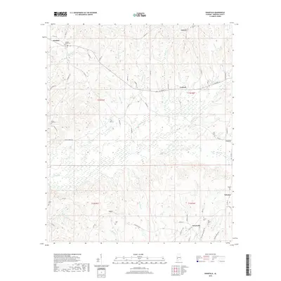
2018 Map of Nanafalia
USGS Topo · Published 2018About this map
Nanafalia and Nicholsville anchor this rural Marengo County landscape, which is defined by a dense network of creeks feeding into the larger river systems of western Alabama. The terrain is deeply etched by Sweetwater Cr, Horse Cr, and Pill Berry Cr, creating a complex topography of ridges and bottoms. Settlement patterns follow the high ground along routes like AL Highway 10, connecting small communities such as Aimwell, Coxheath, and Lasca. For genealogists, the map is particularly revealing, preserving the locations of numerous family and church burial grounds, including the Old Liberty Cem and Luker Cem. These sites, often situated at the ends of winding local roads like Old Liberty Cemetery Rd or near rural junctions, offer a clear view of the area's social and community geography in the early twenty-first century.
Find a feature on this map
71 named features on this map. Tap any name to fly to it.
Don’t see what you’re looking for? This feature index may not catch every label — zoom into the map to look around manually.
Map Details
Editions of this 2018 Nanafalia Map
This is the sole edition of this map. No revisions or reprints were ever made.
Other maps of this area

1953 · Montgomery
USGS Topo · 1:250,000

1953 · Andalusia
USGS Topo · 1:250,000

1953 · Hattiesburg
USGS Topo · 1:250,000

1953 · Meridian
USGS Topo · 1:250,000

1956 · Montgomery
USGS Topo · 1:250,000

1957 · Meridian
USGS Topo · 1:250,000

1957 · Montgomery
USGS Topo · 1:250,000

1957 · Andalusia
USGS Topo · 1:250,000

1958 · Hattiesburg
USGS Topo · 1:250,000

1965 · Meridian
USGS Topo · 1:250,000