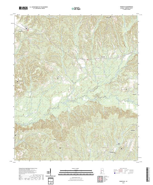
2024 Map of Nanafalia
USGS Topo · Published 2024About this map
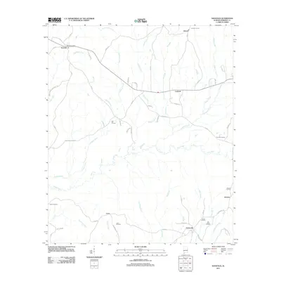
Sweetwater Creek and its many tributaries, including Nichols Creek and Pill Berry Creek, define the drainage patterns of this Marengo County landscape. Small rural communities like Nanafalia, Aimwell, and Nicholsville are connected by a network of local routes such as Co HWY 18 and AL Highway 10. The map is particularly dense with burial sites, reflecting a well-established history of family and community settling. Researchers can trace the proximity of early settlements to water sources and church-related grounds, such as the Nanafalia Baptist Cem and Saint Paul Cem. The southern portion of the quadrangle shows distinct branch systems like Indian Branch and Good Spring Branch feeding into Deep Creek, marking the varied topography between Lasca and Hoboken.
Find a feature on this map
71 named features on this map. Tap any name to fly to it.
Don’t see what you’re looking for? This feature index may not catch every label — zoom into the map to look around manually.
Map Details
Editions of this 2024 Nanafalia Map
This is the sole edition of this map. No revisions or reprints were ever made.
Historical Maps of Sweet Water Through Time
6 maps found