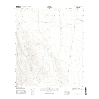
2016 Map of Nancy Anne Ranch
USGS Topo · Published 2016About this map
The high desert uplands of Presidio County are defined here by the steep elevations of Sierra Vieja, where the landscape is marked by a complex system of drainage draws and isolated water sources. This 2016 survey captures the rural infrastructure of the region, anchored by the Nancy Anne Ranch and supported by essential water catchments such as Durazno Tank and N Tank. The terrain is deeply incised by ephemeral waterways including Red Mill Draw, Walnut Draw, and Wild Horse Draw, which serve as the primary geographical markers in this arid environment.
Find a feature on this map
17 named features on this map. Tap any name to fly to it.
Don’t see what you’re looking for? This feature index may not catch every label — zoom into the map to look around manually.
Map Details
Editions of this 2016 Nancy Anne Ranch Map
This is the sole edition of this map. No revisions or reprints were ever made.
Other maps of this area

1892 · Chispa
USGS Topo · 1:125,000

1894 · Valentine
USGS Topo · 1:125,000

1895 · Chispa
USGS Topo · 1:125,000

1895 · Marfa
USGS Topo · 1:125,000

1896 · San Carlos
USGS Topo · 1:125,000

1897 · Valentine
USGS Topo · 1:125,000

1897 · Chispa
USGS Topo · 1:125,000

1943 · Valentine
USGS Topo · 1:125,000

1959 · Marfa
USGS Topo · 1:250,000

1965 · Marfa
USGS Topo · 1:250,000