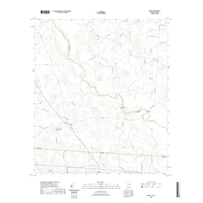
2020 Map of Nankin
USGS Topo · Published 2020About this map
The Withlacoochee River winds through this landscape on the border of Georgia and Florida, serving as the natural dividing line between Brooks and Lowndes counties. Near the settlement of Nankin, the terrain is defined by low-lying wetlands and scattered water bodies like Fearnside Lake and Mud Lake. Local history is anchored by several burial sites and religious landmarks, including the Columbia Primitive Baptist Church Cem and the Wade Cem, which are situated along the network of rural roads that connect the timberlands and farms of the southern coastal plain. Elevated features such as Godwin Bluff overlook the river valley, while the southern margin of the sheet captures the interstate transition into Madison County, Florida, marked by Co Rd 87.
Find a feature on this map
66 named features on this map. Tap any name to fly to it.
Don’t see what you’re looking for? This feature index may not catch every label — zoom into the map to look around manually.
Map Details
Editions of this 2020 Nankin Map
This is the sole edition of this map. No revisions or reprints were ever made.
Other maps of this area

1954 · Valdosta
USGS Topo · 1:250,000

1956 · Clyattville
USGS Topo · 1:24,000

1956 · Nankin
USGS Topo · 1:24,000

1956 · Baden
USGS Topo · 1:24,000

1958 · Valdosta
USGS Topo · 1:250,000

1959 · Valdosta
USGS Topo · 1:250,000

1960 · Cherry Lake
USGS Topo · 1:24,000

1960 · Pinetta
USGS Topo · 1:24,000

1961 · Quitman
USGS Topo · 1:62,500

1961 · Valdosta
USGS Topo · 1:24,000