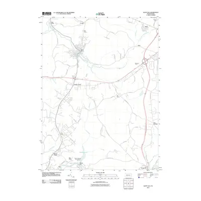
2010 Map of Nanty Glo
USGS Topo · Published 2010About this map
Nanty Glo serves as a central hub in this landscape of the Allegheny Front, where the South Branch Blacklick Creek winds through narrow valleys. The settlement patterns reflect industrial and municipal infrastructure, including the Ebensburg Airport and the expansive Saltlick Reservoir controlled by the Greater Johnstown Water Authority Dam. Smaller communities like Twin Rocks, Revloc, and Beula are connected by a network of local roads such as Old Trolley Car Rd and Allie Buck Rd. To the south, the terrain descends toward the Little Conemaugh River at Mineral Point and Echo. This era shows a mix of established residential blocks and large-scale water management systems, with significant local history sites such as Saint Marys Cemetery and Saint Pauls Cemetery preserved amidst the shifting landscape.
Find a feature on this map
71 named features on this map. Tap any name to fly to it.
Don’t see what you’re looking for? This feature index may not catch every label — zoom into the map to look around manually.
Map Details
Editions of this 2010 Nanty Glo Map
This is the sole edition of this map. No revisions or reprints were ever made.
Other maps of this area

1902 · Ebensburg
USGS Topo · 1:62,500

1902 · Patton
USGS Topo · 1:62,500

1902 · Barnesboro
USGS Topo · 1:62,500

1904 · Barnesboro
USGS Topo · 1:62,500

1904 · Patton
USGS Topo · 1:62,500

1904 · Ebensburg
USGS Topo · 1:62,500

1904 · Johnstown
USGS Topo · 1:62,500

1907 · Johnstown
USGS Topo · 1:62,500

1943 · Punxsutawney
USGS Topo · 1:125,000

1953 · Pittsburgh
USGS Topo · 1:250,000
Featured Places
- Nanty Glo, PA
- Summerhill, PA
- Mineral Point, East Taylor Township
- Beula, Cambria Township
- Revloc, Cambria Township