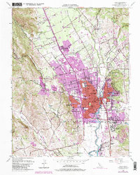
1951 Map of Napa
USGS Topo · Published 1982About this map
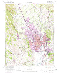
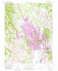
Napa serves as the focal point for this 1951 mid-century survey, which reveals the transition from agricultural valley floor to burgeoning suburban expansion. The city is defined by its relation to the Napa River and the tracks of the Southern Pacific railroad, with core institutions such as the Courthouse, High School, and Napa State Hospital clearly delineated. Just east of the city center lies the Tulocay Cem and the Juarez Old Adobe, a notable remnant of the area's early California heritage.
Find a feature on this map
75 named features on this map. Tap any name to fly to it.
Don’t see what you’re looking for? This feature index may not catch every label — zoom into the map to look around manually.
Map Details
Editions of this 1951 Napa Map
6 editions found
Other maps of this area

1896 · Carquinez Strait
USGS Topo · 1:62,500

1898 · Karquines
USGS Topo · 1:62,500

1901 · Karquines
USGS Topo · 1:62,500

1902 · Napa
USGS Topo · 1:125,000

1916 · Mare Island
USGS Topo · 1:62,500

1921 · Mt. Vaca
USGS Topo · 1:62,500

1940 · Carquinez Strait
USGS Topo · 1:62,500

1942 · Mare Island
USGS Topo · 1:62,500

1942 · Carquinez
USGS Topo · 1:62,500

1942 · Sonoma
USGS Topo · 1:62,500