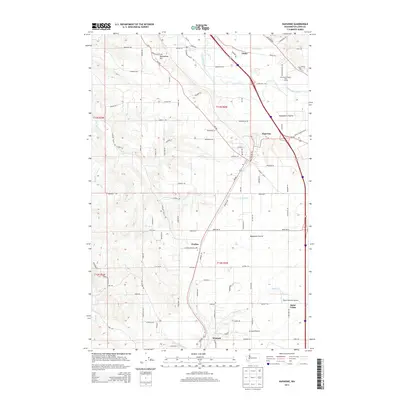
2014 Map of Napavine
USGS Topo · Published 2014About this map
Napavine sits at the heart of this Lewis County landscape, where the flat expanses of Napavine Prairie and Grand Prairie meet the rising slopes of Newaukum Hill. The drainage patterns of Olequa Cr and Stearns Cr define the local topography, historically supporting the agricultural and timber interests that shaped these communities. Near the southern boundary, the town of Winlock appears alongside the small settlement of Saint Urban, connected by a network of rural routes like Jackson Hwy. The landscape transitions from the residential clusters of Napavine to the open fields of Newaukum Prairie and specialized sites such as Pilot's Pastures Airport. This survey provides a look at the intersection of rural industry and growing townships as they appeared in the early 21st century, from the banks of the Newaukum River to the heights of Buckhorn Mountain.
Find a feature on this map
97 named features on this map. Tap any name to fly to it.
Don’t see what you’re looking for? This feature index may not catch every label — zoom into the map to look around manually.
Map Details
Editions of this 2014 Napavine Map
This is the sole edition of this map. No revisions or reprints were ever made.
Other maps of this area

1916 · Chehalis
USGS Topo · 1:125,000

1941 · Meskill
USGS Topo · 1:62,500

1941 · Olequa
USGS Topo · 1:62,500

1953 · Hoquiam
USGS Topo · 1:250,000

1953 · Castle Rock
USGS Topo · 1:62,500

1953 · Ryderwood
USGS Topo · 1:62,500

1953 · Adna
USGS Topo · 1:62,500

1954 · Centralia
USGS Topo · 1:62,500

1957 · Hoquiam
USGS Topo · 1:250,000

1958 · Hoquiam
USGS Topo · 1:250,000