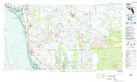
1985 Map of Naples
USGS Topo · Published 1986About this map
Naples and the burgeoning communities of southwest Florida are shown in this mid-1980s topographic-bathymetric study. The map illustrates the rapid residential expansion of coastal areas like North Naples and Golden Gate alongside the vast, protected wetlands of the interior. The Big Cypress National Preserve and Fakahatchee Strand State Preserve dominate the eastern half of the sheet, revealing the complex water systems of the Okaloacoochee Slough and Bear Island Strand.
Find a feature on this map
58 named features on this map. Tap any name to fly to it.
Don’t see what you’re looking for? This feature index may not catch every label — zoom into the map to look around manually.
Map Details
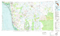
Editions of this 1985 Naples Map
2 editions found
Other maps of this area

1956 · Miami
USGS Topo · 1:250,000

1956 · West Palm Beach
USGS Topo · 1:250,000

1956 · Tampa
USGS Topo · 1:250,000

1956 · Charlotte Harbor
USGS Topo · 1:250,000

1957 · West Palm Beach
USGS Topo · 1:250,000

1958 · West Palm Beach
USGS Topo · 1:250,000

1958 · Miami
USGS Topo · 1:250,000

1958 · Corkscrew SE
USGS Topo · 1:24,000

1958 · Bonita Springs
USGS Topo · 1:24,000

1958 · Belle Meade
USGS Topo · 1:24,000