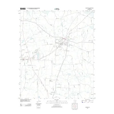
2012 Map of Naples
USGS Topo · Published 2012About this map
Naples and its neighbor Omaha anchor this portion of Morris County, revealing a landscape defined by small-town grids and a dense network of country roads. The map illustrates a high concentration of small family and community burial grounds, including Milner Cem, Heard Cem, and Morning Star Cem, which serve as vital markers for local genealogical research. These sites are scattered among the tributaries of Village Cr and Caney Cr, showing the historical pattern of settlement along these watercourses.
Find a feature on this map
116 named features on this map. Tap any name to fly to it.
Don’t see what you’re looking for? This feature index may not catch every label — zoom into the map to look around manually.
Map Details
Editions of this 2012 Naples Map
This is the sole edition of this map. No revisions or reprints were ever made.
Other maps of this area

1914 · Daingerfield
USGS Topo · 1:62,500

1930 · Bassett
USGS Topo · 1:62,500

1953 · Texarkana
USGS Topo · 1:250,000

1956 · Texarkana
USGS Topo · 1:250,000

1964 · Daingerfield
USGS Topo · 1:24,000

1964 · Cason
USGS Topo · 1:24,000

1965 · Marietta
USGS Topo · 1:24,000

1965 · Dalby Springs
USGS Topo · 1:24,000
1965 · Sardis
USGS Topo · 1:24,000
1965 · Bassett
USGS Topo · 1:24,000