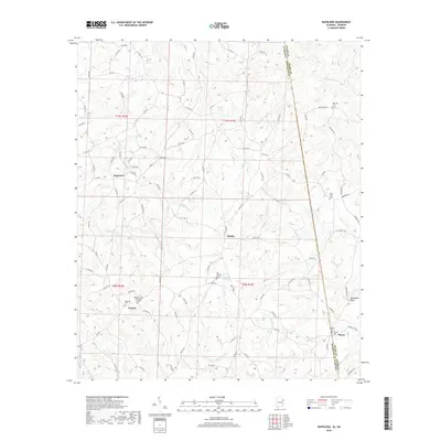
2018 Map of Napoleon
USGS Topo · Published 2018About this map
Napoleon and Omaha anchor this rural landscape along the Alabama and Georgia border, where the terrain is defined by a dense network of creeks flowing toward the Wedowee Cr and Wehadkee Cr. In this corner of Randolph County, the settlement pattern is marked by small crossroads communities and several family and community burial grounds, such as Big Springs Cem and High Point Cem. The map illustrates a transition from the agricultural uplands near Potash to the winding watercourses of Hillabahatchee Cr and Town Cr in the north.
Find a feature on this map
101 named features on this map. Tap any name to fly to it.
Don’t see what you’re looking for? This feature index may not catch every label — zoom into the map to look around manually.
Map Details
Editions of this 2018 Napoleon Map
This is the sole edition of this map. No revisions or reprints were ever made.
Other maps of this area

1899 · Wedowee
USGS Topo · 1:125,000

1902 · Wedowee
USGS Topo · 1:125,000

1953 · Atlanta
USGS Topo · 1:250,000

1957 · Atlanta
USGS Topo · 1:250,000

1958 · Atlanta
USGS Topo · 1:250,000

1964 · Glenn
USGS Topo · 1:24,000

1964 · Roopville
USGS Topo · 1:24,000
1964 · Frolona
USGS Topo · 1:24,000
1969 · Roanoke East
USGS Topo · 1:24,000
1969 · Newell
USGS Topo · 1:24,000