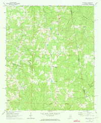
1969 Map of Napoleon
USGS Topo · Published 1973About this map
Napoleon and Omaha anchor this late 1960s study of the Randolph and Heard County borderlands, where Alabama meets Georgia. The landscape is defined by the winding course of Wedowee Creek and Hillabahatchee Creek, serving as a backdrop for numerous rural congregations including Mount Carmel Ch, Liberty East Ch, and Red Oak Ch. Small crossroads like Potash and the evocatively named Tin Shop point to the dispersed settlement patterns typical of this agricultural region.
Find a feature on this map
29 named features on this map. Tap any name to fly to it.
Don’t see what you’re looking for? This feature index may not catch every label — zoom into the map to look around manually.
Map Details
Editions of this 1969 Napoleon Map
This is the sole edition of this map. No revisions or reprints were ever made.
Other maps of this area

1899 · Wedowee
USGS Topo · 1:125,000

1902 · Wedowee
USGS Topo · 1:125,000

1953 · Atlanta
USGS Topo · 1:250,000

1957 · Atlanta
USGS Topo · 1:250,000

1958 · Atlanta
USGS Topo · 1:250,000

1964 · Glenn
USGS Topo · 1:24,000

1964 · Roopville
USGS Topo · 1:24,000
1964 · Frolona
USGS Topo · 1:24,000
1969 · Roanoke East
USGS Topo · 1:24,000
1969 · Newell
USGS Topo · 1:24,000