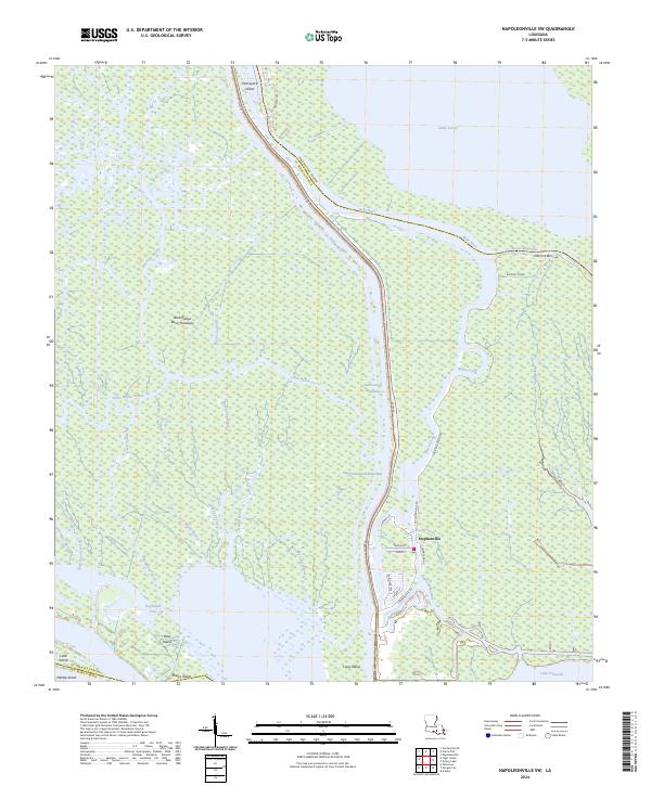
2024 Map of Napoleonville SW
USGS Topo · Published 2024About this map
Stephenville serves as the primary hub of human settlement in this watery landscape, where the Belle River and Intracoastal Waterway intersect within the sprawling Atchafalaya Basin Floodway. The map captures a complex network of bayous and canals that define the region's geography, from the larger basins of Lake Verret and Lake Palourde to the winding paths of Little Bayou Sorrel and Bayou Long.
Find a feature on this map
46 named features on this map. Tap any name to fly to it.
Don’t see what you’re looking for? This feature index may not catch every label — zoom into the map to look around manually.
Map Details
Editions of this 2024 Napoleonville SW Map
This is the sole edition of this map. No revisions or reprints were ever made.
Other maps of this area

1935 · Morgan City
USGS Topo · 1:62,500

1941 · Belle Isle
USGS Topo · 1:62,500

1945 · New Orleans
USGS Topo · 1:250,000

1948 · Foster
USGS Topo · 1:62,500

1953 · Napoleonville
USGS Topo · 1:62,500

1954 · Morgan City
USGS Topo · 1:62,500

1954 · Belle Isle
USGS Topo · 1:62,500

1959 · Foster
USGS Topo · 1:62,500

1963 · New Orleans
USGS Topo · 1:250,000
1965 · Grassy Lake
USGS Topo · 1:24,000