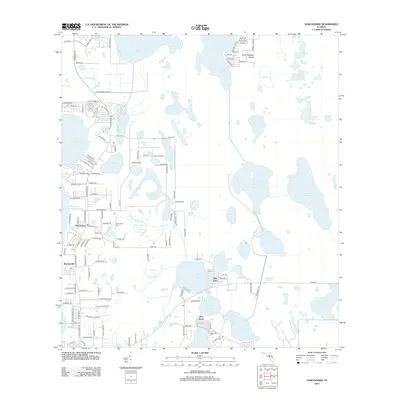
2012 Map of Narcoossee
USGS Topo · Published 2012About this map
East Lake Tohopekaliga defines the western edge of this landscape, anchoring a series of smaller water bodies that shape the local geography. The community of Narcoossee stands as a primary hub of activity, where residential roads like Dan Smith Rd and Kirby Smith Rd branch out toward the surrounding lakes. To the south, the settlement of Runnymede sits adjacent to Lake Runnymede, while the Narcoossee Cem provides a point of genealogical interest for those tracing family roots in this corner of Central Florida.
Find a feature on this map
123 named features on this map. Tap any name to fly to it.
Don’t see what you’re looking for? This feature index may not catch every label — zoom into the map to look around manually.
Map Details
Editions of this 2012 Narcoossee Map
This is the sole edition of this map. No revisions or reprints were ever made.
Other maps of this area

1953 · Narcoossee NE
USGS Topo · 1:24,000

1953 · Narcoossee SE
USGS Topo · 1:24,000

1953 · St Cloud North
USGS Topo · 1:24,000

1953 · Narcoossee
USGS Topo · 1:24,000

1953 · St Cloud South
USGS Topo · 1:24,000

1953 · Ashton
USGS Topo · 1:24,000

1953 · Holopaw
USGS Topo · 1:24,000

1953 · Pine Castle
USGS Topo · 1:24,000

1953 · Narcoossee NW
USGS Topo · 1:24,000

1955 · Orlando
USGS Topo · 1:250,000