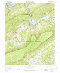
1965 Map of Narrows
USGS Topo · Published 1975About this map
New River carves through the central corridor of this survey, where the town of Narrows sits at a strategic gap between Peters Mountain and Pearis Mountain. The landscape is dominated by the ridges and valleys of the Jefferson National Forest, with the Appalachian Trail winding across the high ground near Angels Rest. Transport and industry follow the water, with the Norfolk and Western railway lines flanking the riverbanks and passing through the hydroelectric hub at Glen Lyn. Small family and community landmarks are scattered through the tributary hollows of Wolf Creek and Sugar Run, including Woolwine Cem, Blankenship Cem, and the rural settlement of Thessalia. Significant elevation changes are marked by features like Sentinel Point and Turnhole Knob, illustrating the difficult terrain that funneled development into the river narrows.
Find a feature on this map
34 named features on this map. Tap any name to fly to it.
Don’t see what you’re looking for? This feature index may not catch every label — zoom into the map to look around manually.
Map Details
Editions of this 1965 Narrows Map
4 editions found
Other maps of this area

1890 · Dublin
USGS Topo · 1:125,000

1891 · Dublin
USGS Topo · 1:125,000

1913 · Peterstown
USGS Topo · 1:48,000

1916 · Peterstown
USGS Topo · 1:62,500

1923 · Pearisburg
USGS Topo · 1:62,500

1925 · Peterstown
USGS Topo · 1:62,500

1932 · Peterstown
USGS Topo · 1:48,000

1932 · Pearisburg
USGS Topo · 1:48,000

1934 · Pulaski
USGS Topo · 1:48,000

1937 · Pearisburg
USGS Topo · 1:62,500