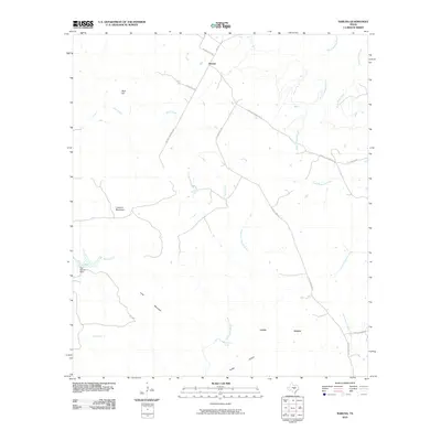
2010 Map of Naruna
USGS Topo · Published 2010About this map
Naruna stands at the northern edge of this Burnet County landscape, where the open spaces of Horse Prairie meet a complex network of seasonal creeks and limestone hills. The geography is defined by high points like Lookout Mountain and Wolf Hill, which offer commanding views over the surrounding ranch lands. Water sources are critical features in this dry terrain, ranging from the Owl Hollow Dam on Beaver Creek to the reliable Persimmon Spring feeding into the North Fork Morgan Creek.
Find a feature on this map
26 named features on this map. Tap any name to fly to it.
Don’t see what you’re looking for? This feature index may not catch every label — zoom into the map to look around manually.
Map Details
Editions of this 2010 Naruna Map
This is the sole edition of this map. No revisions or reprints were ever made.
Other maps of this area

1887 · Lampasas
USGS Topo · 1:125,000

1887 · Burnet
USGS Topo · 1:125,000

1893 · Burnet
USGS Topo · 1:125,000

1894 · Lampasas
USGS Topo · 1:125,000

1903 · Burnet
USGS Topo · 1:125,000

1909 · Burnet
USGS Topo · 1:125,000
1925 · Burnet 2-c
USGS Topo · 1:48,000

1932 · Tow
USGS Topo · 1:62,500

1954 · Brownwood
USGS Topo · 1:250,000

1954 · Lampasas
USGS Topo · 1:62,500