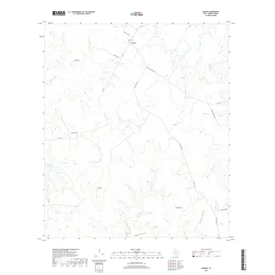
2019 Map of Naruna
USGS Topo · Published 2019About this map
Naruna sits at the northern edge of this Burnet County landscape, where the local road network reflects generations of movement between high ground and water sources. The area is defined by a series of prominent elevations including Wolf Hill, Lookout Mtn, and Long Mtn, which overlook a complex drainage system. Waterways such as Deer Cr and Pecan Spring Br cut through the terrain, leading toward significant landmarks like Owl Hollow Lake. The road names themselves provide a window into local history and destination points, with Dobyville Cemetery Rd and Old San Saba Rd tracing traditional routes through the hills. Genealogists will find the Naruna Cem near the primary settlement, while the presence of Horse Prairie and Persimmon Spring suggests the enduring agricultural and pastoral character of this Central Texas region.
Find a feature on this map
28 named features on this map. Tap any name to fly to it.
Don’t see what you’re looking for? This feature index may not catch every label — zoom into the map to look around manually.
Map Details
Editions of this 2019 Naruna Map
This is the sole edition of this map. No revisions or reprints were ever made.
Other maps of this area

1887 · Lampasas
USGS Topo · 1:125,000

1887 · Burnet
USGS Topo · 1:125,000

1893 · Burnet
USGS Topo · 1:125,000

1894 · Lampasas
USGS Topo · 1:125,000

1903 · Burnet
USGS Topo · 1:125,000

1909 · Burnet
USGS Topo · 1:125,000
1925 · Burnet 2-c
USGS Topo · 1:48,000

1932 · Tow
USGS Topo · 1:62,500

1954 · Brownwood
USGS Topo · 1:250,000

1954 · Lampasas
USGS Topo · 1:62,500