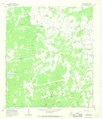
1967 Map of Naruna
USGS Topo · Published 1970About this map
Naruna sits at the northern edge of this Burnet County landscape, a central point in a region defined by working ranch lands and active extractive industries in the late 1960s. The terrain is characterized by a high frequency of resource extraction sites, such as the Bunker Gravel Pit and numerous other unnamed Gravel Pits, suggesting a localized economy heavily tied to road materials and construction. Toward the south, the open expanse of Horse Prairie contrasts with the more broken country around Wolf Hill and Lookout Mountain. Water sources appear vital but seasonal, including the North Fork Morgan Creek and the distinct Persimmon Spring. A lone Landing Strip provides a small window into the mid-century aviation infrastructure serving these remote Texas ranching communities.
Find a feature on this map
21 named features on this map. Tap any name to fly to it.
Don’t see what you’re looking for? This feature index may not catch every label — zoom into the map to look around manually.
Map Details
Editions of this 1967 Naruna Map
This is the sole edition of this map. No revisions or reprints were ever made.
Other maps of this area

1887 · Lampasas
USGS Topo · 1:125,000

1887 · Burnet
USGS Topo · 1:125,000

1893 · Burnet
USGS Topo · 1:125,000

1894 · Lampasas
USGS Topo · 1:125,000

1903 · Burnet
USGS Topo · 1:125,000

1909 · Burnet
USGS Topo · 1:125,000
1925 · Burnet 2-c
USGS Topo · 1:48,000

1932 · Tow
USGS Topo · 1:62,500

1954 · Brownwood
USGS Topo · 1:250,000

1954 · Lampasas
USGS Topo · 1:62,500