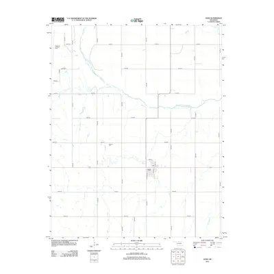
2012 Map of Nash
USGS Topo · Published 2012About this map
The town of Nash sits at the junction of several section roads in Grant County, characterized by a structured grid and a scattering of small watercourses. The most prominent natural feature is the Salt Fork Arkansas River, which winds across the northern half of the landscape. It is joined by smaller drainages such as Wagon Cr and Coldwater Cr, creating a hydrologic network that likely influenced the local agricultural development. The landscape is also marked by the Kegelman Auxiliary Field in the northwest, suggesting a history of aviation or military utility in this part of Oklahoma. For those looking for local history, the Dunkard Cem provides a specific point of genealogical interest north of the town center, while the street names in Nash, including California Ave and Main St, offer a clear look at the village's core layout in 2012.
Find a feature on this map
29 named features on this map. Tap any name to fly to it.
Don’t see what you’re looking for? This feature index may not catch every label — zoom into the map to look around manually.
Map Details
Editions of this 2012 Nash Map
This is the sole edition of this map. No revisions or reprints were ever made.
Other maps of this area

1955 · Enid
USGS Topo · 1:250,000

1955 · Woodward
USGS Topo · 1:250,000

1958 · Enid
USGS Topo · 1:250,000

1958 · Woodward
USGS Topo · 1:250,000

1968 · Hillsdale
USGS Topo · 1:24,000

1968 · Pond Creek NW
USGS Topo · 1:24,000

1968 · Wakita SW
USGS Topo · 1:24,000

1969 · Jet
USGS Topo · 1:24,000

1969 · Goltry
USGS Topo · 1:24,000

1969 · Nash
USGS Topo · 1:24,000