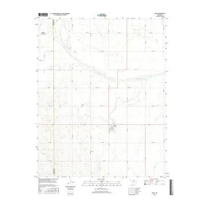
2016 Map of Nash
USGS Topo · Published 2016About this map
Nash serves as the central hub of this agricultural landscape in northwestern Oklahoma, situated along the county line between Alfalfa Co and Grant Co. The geography is defined by the sweeping course of the Salt Fork Arkansas River, which meanders across the northern half of the sheet, joined by smaller tributaries like Wagon Cr and Coldwater Cr. The map preserves important genealogy and community markers, such as Dunkard Cem and New Home Cem, reflecting the early settlement patterns of the region.
Find a feature on this map
32 named features on this map. Tap any name to fly to it.
Don’t see what you’re looking for? This feature index may not catch every label — zoom into the map to look around manually.
Map Details
Editions of this 2016 Nash Map
This is the sole edition of this map. No revisions or reprints were ever made.
Other maps of this area

1955 · Enid
USGS Topo · 1:250,000

1955 · Woodward
USGS Topo · 1:250,000

1958 · Enid
USGS Topo · 1:250,000

1958 · Woodward
USGS Topo · 1:250,000

1968 · Hillsdale
USGS Topo · 1:24,000

1968 · Pond Creek NW
USGS Topo · 1:24,000

1968 · Wakita SW
USGS Topo · 1:24,000

1969 · Jet
USGS Topo · 1:24,000

1969 · Goltry
USGS Topo · 1:24,000

1969 · Nash
USGS Topo · 1:24,000