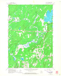
1965 Map of Nashville
USGS Topo · Published 1966About this map
The Wolf River winds through this northern Wisconsin landscape, marking a terrain defined by glacial lakes and the logging-era infrastructure of Oneida Co and Forest Co. The Chicago and North Western railroad bisects the northern section, connecting the settlement of Monico to the broader regional network. To the south, the local economy and social fabric are anchored by smaller communities like Lennox, Jennings, and Nashville. Genealogists will find a wealth of local data, with several burial grounds including Nashville Cem, Wolfram Cem, St Marys Cem, and Forest Home Cem plotted across the townships. Cultural and industrial markers are evident in the Old Railroad Grade and the Wolf River Lookout Tower, alongside several Gravel Pits that suggest the primary extraction activities of the mid-1960s. Large water bodies such as Little Rice Lake and Lake Lucille dominate the topography, providing a detailed view of the Northwoods before modern development.
Find a feature on this map
28 named features on this map. Tap any name to fly to it.
Don’t see what you’re looking for? This feature index may not catch every label — zoom into the map to look around manually.
Map Details
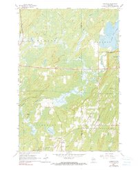
Editions of this 1965 Nashville Map
2 editions found
Other maps of this area

1939 · Crandon
USGS Topo · 1:48,000

1940 · Monico
USGS Topo · 1:48,000

1941 · Crandon
USGS Topo · 1:48,000

1942 · Elcho
USGS Topo · 1:48,000

1942 · Pearson
USGS Topo · 1:48,000

1947 · Crandon
USGS Topo · 1:48,000

1950 · Monico
USGS Topo · 1:48,000

1950 · Elcho
USGS Topo · 1:48,000

1950 · Lily
USGS Topo · 1:48,000

1954 · Iron Mountain
USGS Topo · 1:250,000