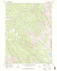
1970 Map of Nast
USGS Topo · Published 1973About this map
The headwaters of the Fryingpan River and its numerous forks dominate this high-altitude landscape within the White River National Forest. A notable engineering presence is visible through the Fryingpan-Arkansas North Side Collection System and the Charles H. Boustead Tunnel, which redirect water through the Continental Divide into the San Isabel National Forest. Local activity centers around the settlement of Nast and the nearby Horseshoe Bend Ranch, located just downstream from the Nast Tunnel. Numerous high-country lakes such as Ivanhoe Lake, Savage Lakes, and Mormon Lake sit among the peaks, connected by a network of paths including the Lyle Pack Trail and Last Chance Trail. Factual evidence of early resource extraction persists with a Kiln at Sellar Park and a Prospect located near Ivanhoe Creek.
Find a feature on this map
48 named features on this map. Tap any name to fly to it.
Don’t see what you’re looking for? This feature index may not catch every label — zoom into the map to look around manually.
Map Details
Editions of this 1970 Nast Map
3 editions found
Other maps of this area

1889 · Leadville
USGS Topo · 1:125,000

1891 · Leadville
USGS Topo · 1:125,000

1909 · Mount Jackson
USGS Topo · 1:125,000

1911 · Mount Jackson
USGS Topo · 1:125,000

1935 · Mount Elbert
USGS Topo · 1:62,500

1938 · Mount Elbert
USGS Topo · 1:62,500

1939 · Mount Elbert
USGS Topo · 1:62,500

1942 · Leadville
USGS Topo · 1:125,000

1949 · Holy Cross
USGS Topo · 1:62,500

1951 · Holy Cross
USGS Topo · 1:62,500