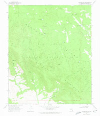
1967 Map of Natanes Mts NW
USGS Topo · Published 1974About this map
The San Carlos Indian Reservation encompasses this high-elevation landscape within the Natanes Plateau and Natanes Mountains. Grounded by the 1967 field check, the map reveals a network of water sources critical for life and movement through this arid environment, including Old Summit Springs, Bill Simmons Spring, and several named livestock tanks like Double Circle Tank. The terrain is deeply dissected by drainages such as Sawmill Canyon and Ash Fork Creek. Evidence of land management and surveillance is found at the Edwards Lookout Tower, while the sparse infrastructure of the era is represented by a series of Jeep Trails and Pack Trails that follow natural contours and watercourses. This survey records a remote and strictly managed landscape, where the naming of individual springs like Soldier Hole Spring marks essential waypoints for navigation.
Find a feature on this map
29 named features on this map. Tap any name to fly to it.
Don’t see what you’re looking for? This feature index may not catch every label — zoom into the map to look around manually.
Map Details
Editions of this 1967 Natanes Mts NW Map
3 editions found
Other maps of this area

1954 · Clifton
USGS Topo · 1:250,000

1954 · Mesa
USGS Topo · 1:250,000

1957 · Mesa
USGS Topo · 1:250,000

1957 · Clifton
USGS Topo · 1:250,000

1958 · Clifton
USGS Topo · 1:250,000

1958 · Mesa
USGS Topo · 1:250,000

1960 · Mesa
USGS Topo · 1:250,000

1962 · Clifton
USGS Topo · 1:250,000

1964 · Mesa
USGS Topo · 1:250,000

1966 · Georges Butte
USGS Topo · 1:24,000