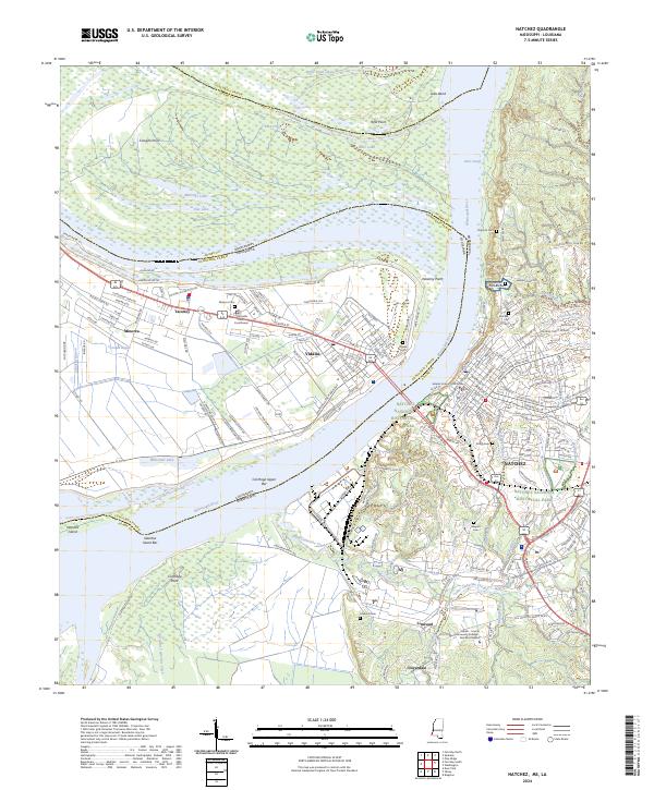
2024 Map of Natchez
USGS Topo · Published 2024About this map
The Mississippi River serves as a massive serpentine border between Louisiana and Mississippi, carving a landscape defined by shifting watercourses like Giles Cutoff and Giles Bend. On the western bank, the town of Vidalia is centered around the Concordia Parish Courthouse, while the eastern bluff holds the city of Natchez. This area is heavy with preserved history and ecology, anchored by Natchez National Historical Park and the expansive Saint Catherine Creek National Wildlife Refuge to the south. Genealogists will find a high concentration of burial sites, including the Natchez City Cem, Vidalia Cem, and the smaller Minorca Cem. The map tracks the varied hydrology of the floodplain, from Whitehall Lake to the remnants of the Old Saint Catherine Creek channel, illustrating how human settlement in places like Taconey and Minorca has adapted to the river's influence over generations.
Find a feature on this map
76 named features on this map. Tap any name to fly to it.
Don’t see what you’re looking for? This feature index may not catch every label — zoom into the map to look around manually.
Map Details
Editions of this 2024 Natchez Map
This is the sole edition of this map. No revisions or reprints were ever made.
Other maps of this area

1909 · Sycamore Landing
USGS Topo · 1:24,000

1909 · Vidalia
USGS Topo · 1:24,000

1921 · Natchez
USGS Topo · 1:48,000

1922 · Natchez
USGS Topo · 1:62,500

1939 · Red Gum
USGS Topo · 1:62,500

1939 · Natchez
USGS Topo · 1:62,500

1939 · Kingston
USGS Topo · 1:62,500

1939 · Deer Park
USGS Topo · 1:62,500

1953 · Natchez
USGS Topo · 1:250,000

1956 · Natchez
USGS Topo · 1:250,000