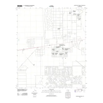
2010 Map of Nations South Well
USGS Topo · Published 2010About this map
Homestead Meadows and a dense network of surrounding colonias define the residential landscape of this region east of El Paso during the first decade of the 2000s. The map illustrates a grid of developing subdivisions, including Homestead Meadows South Number 5 Colonia and Paso View West Colonia, which reflect the rapid suburbanization of the Chihuahuan Desert floor. While much of the land remains divided into large, undeveloped tracts, the concentration of homes in areas like Rockhouse and Deerfield Park Colonia shows the ongoing transformation of the Texas borderlands.
Find a feature on this map
45 named features on this map. Tap any name to fly to it.
Don’t see what you’re looking for? This feature index may not catch every label — zoom into the map to look around manually.
Map Details
Editions of this 2010 Nations South Well Map
This is the sole edition of this map. No revisions or reprints were ever made.
Other maps of this area

1896 · El Paso
USGS Topo · 1:125,000

1908 · El Paso
USGS Topo · 1:125,000

1939 · Ysleta
USGS Topo · 1:62,500

1939 · Heuco Tanks
USGS Topo · 1:62,500

1940 · Heuco Tanks
USGS Topo · 1:62,500

1941 · Clint
USGS Topo · 1:62,500

1941 · Ysleta
USGS Topo · 1:62,500

1942 · Fort Bliss
USGS Topo · 1:62,500

1944 · Heuco Tanks
USGS Topo · 1:62,500

1945 · Ysleta
USGS Topo · 1:62,500
Featured Places
- El Paso, TX
- Las Quintas Number 2 Colonia, TX
- Las Casitas Number 2 Colonia, TX
- Homestead Meadows South, TX
- Paso el Rey Number 3 Colonia, TX