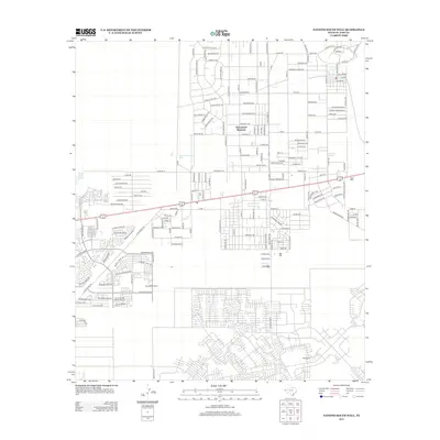
2012 Map of Nations South Well
USGS Topo · Published 2012About this map
Homestead Meadows and the surrounding residential developments east of El Paso define this 2012 landscape, where modern suburban street grids intersect with names that evoke the frontier. The map captures a moment of significant expansion in the Hueco Bolson region, documented through an extensive network of named local roads. To the south, the settlement of Rockhouse sits near the base of the mountain foothills, while the industrial necessity of desert life is marked by numerous water sources, including the namesake Nations South Well, the Hueco Water Wells, and a solitary Deep Well located to the east.
Find a feature on this map
120 named features on this map. Tap any name to fly to it.
Don’t see what you’re looking for? This feature index may not catch every label — zoom into the map to look around manually.
Map Details
Editions of this 2012 Nations South Well Map
This is the sole edition of this map. No revisions or reprints were ever made.
Other maps of this area

1896 · El Paso
USGS Topo · 1:125,000

1908 · El Paso
USGS Topo · 1:125,000

1939 · Ysleta
USGS Topo · 1:62,500

1939 · Heuco Tanks
USGS Topo · 1:62,500

1940 · Heuco Tanks
USGS Topo · 1:62,500

1941 · Clint
USGS Topo · 1:62,500

1941 · Ysleta
USGS Topo · 1:62,500

1942 · Fort Bliss
USGS Topo · 1:62,500

1944 · Heuco Tanks
USGS Topo · 1:62,500

1945 · Ysleta
USGS Topo · 1:62,500
Featured Places
- El Paso, TX
- Las Quintas Number 2 Colonia, TX
- Las Casitas Number 2 Colonia, TX
- Homestead Meadows South, TX
- Paso el Rey Number 3 Colonia, TX