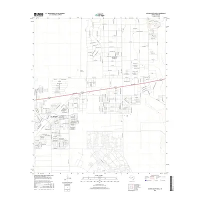
2016 Map of Nations South Well
USGS Topo · Published 2016About this map
Homestead Meadows and the expanding eastern edges of El Paso define this landscape in the mid-2010s. This survey illustrates the dense residential development north of Montana Ave, where a complex grid of streets like Buffalo Creek Dr and Death Valley Ln has replaced the open Chihuahuan Desert. The map serves as a detailed record of suburban growth, showing the transition from established neighborhoods to planned subdivisions. To the south, major thoroughfares including Pebble Hills Blvd and Zaragoza Rd anchor the urban infrastructure. Near the eastern margin, the namesake Nations South Well remains a point of reference in an area marked by both modern housing and topographic features like Hidden Creek. The layout of roads such as Ascencion Rd and Ranch Rd 659 reveals the logistical framework supporting this border region's rapid expansion.
Find a feature on this map
34 named features on this map. Tap any name to fly to it.
Don’t see what you’re looking for? This feature index may not catch every label — zoom into the map to look around manually.
Map Details
Editions of this 2016 Nations South Well Map
This is the sole edition of this map. No revisions or reprints were ever made.
Other maps of this area

1896 · El Paso
USGS Topo · 1:125,000

1908 · El Paso
USGS Topo · 1:125,000

1939 · Ysleta
USGS Topo · 1:62,500

1939 · Heuco Tanks
USGS Topo · 1:62,500

1940 · Heuco Tanks
USGS Topo · 1:62,500

1941 · Clint
USGS Topo · 1:62,500

1941 · Ysleta
USGS Topo · 1:62,500

1942 · Fort Bliss
USGS Topo · 1:62,500

1944 · Heuco Tanks
USGS Topo · 1:62,500

1945 · Ysleta
USGS Topo · 1:62,500
Featured Places
- El Paso, TX
- Las Quintas Number 2 Colonia, TX
- Las Casitas Number 2 Colonia, TX
- Homestead Meadows South, TX
- Paso el Rey Number 3 Colonia, TX