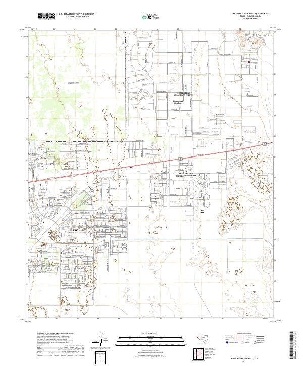
2022 Map of Nations South Well
USGS Topo · Published 2022About this map
El Paso residential expansion reaches toward the desert foothills in this contemporary survey of the eastern Far East side. The landscape is defined by a rigorous grid of residential streets, particularly within the unincorporated communities of Homestead Meadows North and Homestead Meadows South. These areas exhibit a distinct transitional character where suburban development meets the open Chihuahuan Desert, as evidenced by thoroughfares like Jim Bridger Rd and Wagon Wheel Pl. Historically significant pathways are still visible in the modern geography, most notably the Old Butterfield Trl which cuts across the northeastern corner. The map traces the growth of neighborhood clusters like Homestead Meadows against the backdrop of the Yucca Foothills, illustrating the ongoing densification of the El Paso County outskirts.
Find a feature on this map
185 named features on this map. Tap any name to fly to it.
Don’t see what you’re looking for? This feature index may not catch every label — zoom into the map to look around manually.
Map Details
Editions of this 2022 Nations South Well Map
This is the sole edition of this map. No revisions or reprints were ever made.
Other maps of this area

1896 · El Paso
USGS Topo · 1:125,000

1908 · El Paso
USGS Topo · 1:125,000

1939 · Ysleta
USGS Topo · 1:62,500

1939 · Heuco Tanks
USGS Topo · 1:62,500

1940 · Heuco Tanks
USGS Topo · 1:62,500

1941 · Clint
USGS Topo · 1:62,500

1941 · Ysleta
USGS Topo · 1:62,500

1942 · Fort Bliss
USGS Topo · 1:62,500

1944 · Heuco Tanks
USGS Topo · 1:62,500

1945 · Ysleta
USGS Topo · 1:62,500
Featured Places
- El Paso, TX
- Las Quintas Number 2 Colonia, TX
- Las Casitas Number 2 Colonia, TX
- Deerfield Park Colonia, TX
- Homestead Meadows South Number 3 Colonia, TX