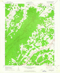
1961 Map of Natural Bridge
USGS Topo · Published 1963About this map
Short Hills dominates the central landscape of this early 1960s survey, a prominent ridge that separates the drainage of Buffalo Creek to the north from Cedar Creek and Spring Gap Creek to the south. The area is characterized by scattered rural settlements and agricultural clusters, most notably the community of Natural Bridge and the nearby Red Mills. The cartography documents a moment of infrastructure growth, showing a section of the Valley Road corridor marked as Under Construction, signaling the modernization of transportation through the Great Valley of Virginia.
Find a feature on this map
40 named features on this map. Tap any name to fly to it.
Don’t see what you’re looking for? This feature index may not catch every label — zoom into the map to look around manually.
Map Details
Editions of this 1961 Natural Bridge Map
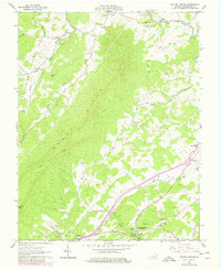
2 editions found
Other maps of this area

1894 · Natural Bridge
USGS Topo · 1:125,000

1894 · Lexington
USGS Topo · 1:125,000

1894 · Natural Bridge
USGS Topo · 1:62,500

1907 · Natural Bridge Special
USGS Topo · 1:62,500

1932 · Lexington
USGS Topo · 1:48,000

1935 · Buena Vista
USGS Topo · 1:48,000

1937 · Lexington
USGS Topo · 1:62,500

1939 · Buena Vista
USGS Topo · 1:62,500

1940 · Buena Vista
USGS Topo · 1:62,500

1946 · Millboro
USGS Topo · 1:62,500