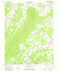
1961 Map of Natural Bridge
USGS Topo · Published 1978About this map
The geologic landmark Natural Bridge anchors the southern portion of this Rockbridge County survey, which documents the landscape as it appeared in the early 1960s with updates from the late 1970s. The region is characterized by the prominent Short Hills and a network of waterways including Buffalo Creek and Cedar Creek. Settlement is concentrated in small communities like Murat, Fancy Hill, and Red Mills, reflecting a rural economy linked by historic corridors such as the Plank Road and Valley Road.
Find a feature on this map
39 named features on this map. Tap any name to fly to it.
Don’t see what you’re looking for? This feature index may not catch every label — zoom into the map to look around manually.
Map Details
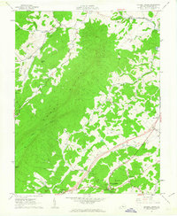
Editions of this 1961 Natural Bridge Map
2 editions found
Other maps of this area

1894 · Natural Bridge
USGS Topo · 1:125,000

1894 · Lexington
USGS Topo · 1:125,000

1894 · Natural Bridge
USGS Topo · 1:62,500

1907 · Natural Bridge Special
USGS Topo · 1:62,500

1932 · Lexington
USGS Topo · 1:48,000

1935 · Buena Vista
USGS Topo · 1:48,000

1937 · Lexington
USGS Topo · 1:62,500

1939 · Buena Vista
USGS Topo · 1:62,500

1940 · Buena Vista
USGS Topo · 1:62,500

1946 · Millboro
USGS Topo · 1:62,500