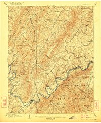
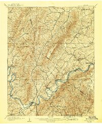
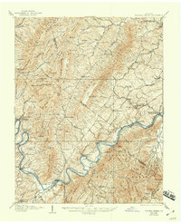
1907 Map of Natural Bridge Special
USGS Topo · Published 1922About this map
Industrial ruins and river-bound commerce define this early 20th-century landscape at the intersection of Rockbridge and Botetourt counties. The iron industry's legacy is visible in the remains of Jane Furnace and Rebecca Furnace near Rocky Ford, while active milling is documented at Rapps Mill, Red Mills, and Gilmore Mills. The James River serves as the central artery for the region, paralleled by competing rail lines including the Norfolk and Western RR and the Chesapeake and Ohio RR.
Find a feature on this map
111 named features on this map. Tap any name to fly to it.
Don’t see what you’re looking for? This feature index may not catch every label — zoom into the map to look around manually.
Map Details
Editions of this 1907 Natural Bridge Special Map
4 editions found
Other maps of this area

1890 · Roanoke
USGS Topo · 1:125,000

1891 · Roanoke
USGS Topo · 1:125,000

1892 · Lynchburg
USGS Topo · 1:125,000

1894 · Natural Bridge
USGS Topo · 1:125,000

1894 · Lexington
USGS Topo · 1:125,000

1894 · Natural Bridge
USGS Topo · 1:62,500

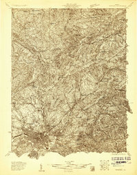
1907 · Natural Bridge Special
USGS Topo · 1:62,500

1913 · Eagle Rock
USGS Topo · 1:48,000

1915 · Eagle Rock
USGS Topo · 1:62,500
1929 · Roanoke
USGS Topo · 1:48,000