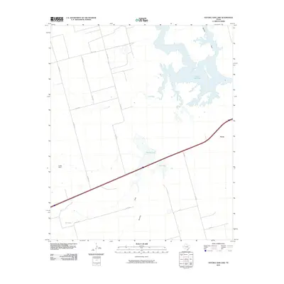
2010 Map of Natural Dam Lake
USGS Topo · Published 2010About this map
Natural Dam Lake dominates the northeastern corner of this West Texas landscape, its sprawling, irregular shoreline illustrating the complex hydrology of the Permian Basin. This arid region is defined by ephemeral drainages and salt-crusted basins, where water is a precious and defining resource. The small settlement of Morita sits along the eastern edge of the quadrangle, serving as a focal point for the surrounding ranching and agricultural operations.
Find a feature on this map
21 named features on this map. Tap any name to fly to it.
Don’t see what you’re looking for? This feature index may not catch every label — zoom into the map to look around manually.
Map Details
Editions of this 2010 Natural Dam Lake Map
This is the sole edition of this map. No revisions or reprints were ever made.
Other maps of this area

1941 · Morita
USGS Topo · 1:62,500

1949 · Morita
USGS Topo · 1:62,500

1954 · Big Spring
USGS Topo · 1:250,000

1958 · Big Spring
USGS Topo · 1:250,000
1966 · Lucian Wells Ranch
USGS Topo · 1:24,000

1966 · Natural Dam Lake
USGS Topo · 1:24,000

1966 · Knott SE
USGS Topo · 1:24,000
1966 · Elbow
USGS Topo · 1:24,000
1966 · Houston Ranch
USGS Topo · 1:24,000

1966 · Stanton
USGS Topo · 1:24,000