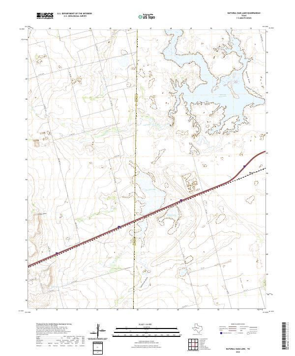
2022 Map of Natural Dam Lake
USGS Topo · Published 2022About this map
The Martin Co Howard Co line bisects this West Texas landscape, where the flat plains of the Llano Estacado give way to significant depressions and ephemeral water systems. Natural Dam Lake dominates the northeast corner, fed by the winding paths of Buzzard Draw and Sulphur Springs Draw. These features represent the unique hydrology of the Permian Basin region, characterized by saline lakes and drainage draws that remain dry most of the year.
Find a feature on this map
31 named features on this map. Tap any name to fly to it.
Don’t see what you’re looking for? This feature index may not catch every label — zoom into the map to look around manually.
Map Details
Editions of this 2022 Natural Dam Lake Map
This is the sole edition of this map. No revisions or reprints were ever made.
Other maps of this area

1941 · Morita
USGS Topo · 1:62,500

1949 · Morita
USGS Topo · 1:62,500

1954 · Big Spring
USGS Topo · 1:250,000

1958 · Big Spring
USGS Topo · 1:250,000
1966 · Lucian Wells Ranch
USGS Topo · 1:24,000

1966 · Natural Dam Lake
USGS Topo · 1:24,000

1966 · Knott SE
USGS Topo · 1:24,000
1966 · Elbow
USGS Topo · 1:24,000
1966 · Houston Ranch
USGS Topo · 1:24,000

1966 · Stanton
USGS Topo · 1:24,000