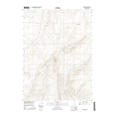
2015 Map of Natwick SW
USGS Topo · Published 2015About this map
Wyoming Development Company Canal cuts across the northern landscape of this Platte County region, reflecting the engineered water management vital to Wyoming’s high-plains development. The terrain is defined by the prominent peak of Sheep Mtn and a complex drainage network where Sybille Cr, Bluegrass Cr, and S Fork Sybille Cr converge. These watercourses were central to the early 20th-century ranching and agricultural efforts that shaped the area. Local infrastructure is represented by routes like Halleck Canyon Rd and Mule Creek Rd, which provide access through the undulating topography. In the southern portion of the quadrangle, Gilbert Reservoir serves as a collection point for local runoff, while Deadhead Cr winds through the eastern sections, illustrating the intricate relationship between the arid landscape and its sparse but essential water resources.
Find a feature on this map
16 named features on this map. Tap any name to fly to it.
Don’t see what you’re looking for? This feature index may not catch every label — zoom into the map to look around manually.
Map Details
Editions of this 2015 Natwick SW Map
This is the sole edition of this map. No revisions or reprints were ever made.
Other maps of this area

1953 · Natwick SW
USGS Topo · 1:24,000

1953 · Natwick
USGS Topo · 1:24,000

1953 · Squaw Rock
USGS Topo · 1:24,000

1953 · Richeau Hills
USGS Topo · 1:24,000

1954 · Cheyenne
USGS Topo · 1:250,000

1955 · Poe Mountain
USGS Topo · 1:24,000

1955 · Moonshine Peak
USGS Topo · 1:24,000

1955 · Indian Guide
USGS Topo · 1:24,000

1958 · Cheyenne
USGS Topo · 1:250,000

1962 · Delano Ranch
USGS Topo · 1:24,000