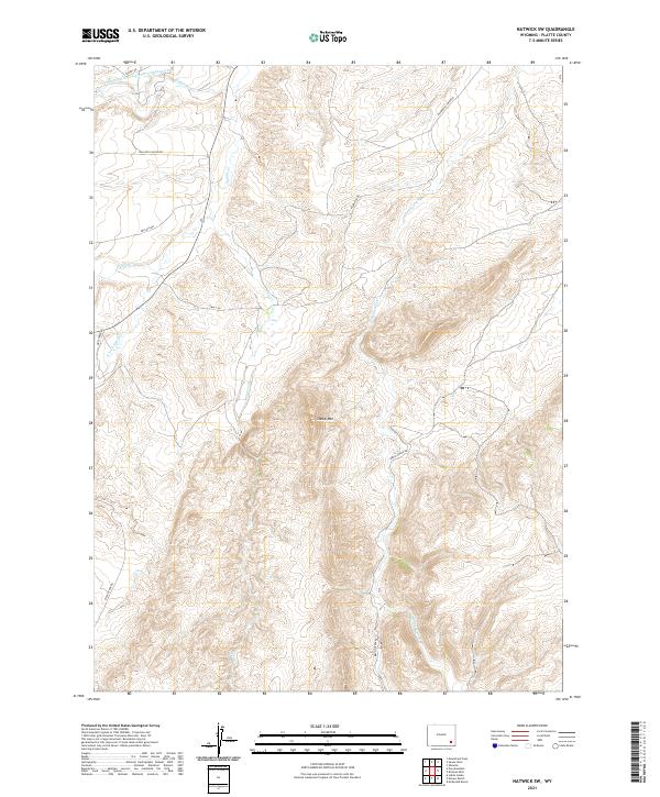
2021 Map of Natwick SW
USGS Topo · Published 2021About this map
Sheep Mtn dominates the central topography of this Wyoming landscape, where the high-plains drainage systems of Platte County are captured in exceptional detail. The northern edge of the map features the Wyoming Development Company Canal, a significant piece of early twentieth-century western water infrastructure designed to transform the arid basin into productive land. Flowing through the winding canyon bottoms are several branches of Sybille Cr and the S Fork Sybille Cr, which provide the primary hydrological network for the surrounding ranching country. Access to this isolated terrain is defined by a network of rural routes including Halleck Canyon Rd, Deadhead Creek Rd, and Brush Creek Rd. The map illustrates the characteristic section-line development of the West, where remote drainages like Mule Cr and Bluegrass Cr intersect with rugged summits.
Find a feature on this map
21 named features on this map. Tap any name to fly to it.
Don’t see what you’re looking for? This feature index may not catch every label — zoom into the map to look around manually.
Map Details
Editions of this 2021 Natwick SW Map
This is the sole edition of this map. No revisions or reprints were ever made.
Other maps of this area

1953 · Natwick SW
USGS Topo · 1:24,000

1953 · Natwick
USGS Topo · 1:24,000

1953 · Squaw Rock
USGS Topo · 1:24,000

1953 · Richeau Hills
USGS Topo · 1:24,000

1954 · Cheyenne
USGS Topo · 1:250,000

1955 · Poe Mountain
USGS Topo · 1:24,000

1955 · Moonshine Peak
USGS Topo · 1:24,000

1955 · Indian Guide
USGS Topo · 1:24,000

1958 · Cheyenne
USGS Topo · 1:250,000

1962 · Delano Ranch
USGS Topo · 1:24,000