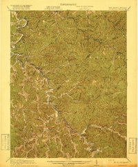
1917 Map of Naugatuck
USGS Topo · Published 1917About this map
Tug Fork carves a winding path along the state boundary, serving as the industrial and transportation spine for this portion of West Virginia and Kentucky. The Norfolk and Western RR tracks follow the river's tight bends, connecting coal-era settlements such as Kermit, Naugatuck, and Warfield. The topography is dominated by narrow hollows and numerous named branches, including Jennie Creek and Wolf Creek, which dictate the placement of small communities like Wilsondale and Breeden.
Find a feature on this map
77 named features on this map. Tap any name to fly to it.
Don’t see what you’re looking for? This feature index may not catch every label — zoom into the map to look around manually.
Map Details
Editions of this 1917 Naugatuck Map
3 editions found
Other maps of this area

1886 · Prestonsburg
USGS Topo · 1:125,000

1887 · Warfield
USGS Topo · 1:125,000

1891 · Warfield
USGS Topo · 1:125,000

1892 · Prestonsburg
USGS Topo · 1:125,000

1892 · Huntington
USGS Topo · 1:125,000

1898 · Huntington
USGS Topo · 1:125,000

1902 · Midkiff
USGS Topo · 1:62,500

1903 · Kenova
USGS Topo · 1:125,000

1904 · Kenova
USGS Topo · 1:125,000

1907 · Midkiff
USGS Topo · 1:62,500