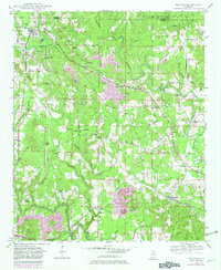
1949 Map of Nauvoo
USGS Topo · Published 1981About this map
Nauvoo and its surrounding coal-country landscapes are documented here during the mid-twentieth century, showing a region where small-scale agriculture met increasing industrial activity. The Southern railroad line serves as a central spine through the terrain, connecting the larger settlement at Nauvoo to smaller points like Prospect and Saragossa. Numerous Strip Mine excavations, indicated by purple revisions from later decades, highlight the shifting land use as resource extraction expanded across the hills of the Winston Co and Walker Co border.
Find a feature on this map
56 named features on this map. Tap any name to fly to it.
Don’t see what you’re looking for? This feature index may not catch every label — zoom into the map to look around manually.
Map Details
Editions of this 1949 Nauvoo Map
2 editions found
Other maps of this area

1893 · Jasper
USGS Topo · 1:125,000

1949 · Townley
USGS Topo · 1:24,000

1949 · Jasper
USGS Topo · 1:24,000

1949 · Manchester
USGS Topo · 1:24,000

1949 · Nauvoo
USGS Topo · 1:24,000

1950 · Nauvoo
USGS Topo · 1:24,000

1950 · Manchester
USGS Topo · 1:24,000

1951 · Jasper
USGS Topo · 1:24,000

1951 · Townley
USGS Topo · 1:24,000

1953 · Birmingham
USGS Topo · 1:250,000